Posted on by

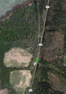
South Hemlock Lake DEC Parking area (42.668316,-77.592123) – Directions

Click the map for directions from Google.

Click the map for directions from Google.

A DEC parking area is located at the south end of the South Hemlock Lake Access Road just off of Rt 15A on the west side of the road.    From the road you will see a boat launch sign for the entrance. This parking area is directly across the road from the Reynolds Gull parking area.

From Springwater: Follow 15A North from Springwater for 2.3 miles.  The parking area is on the left.

From the Wheaton Hill / 15A intersection: Follow 15A North for 1.5 miles from Wheaton Hill.  The parking area is on the left.

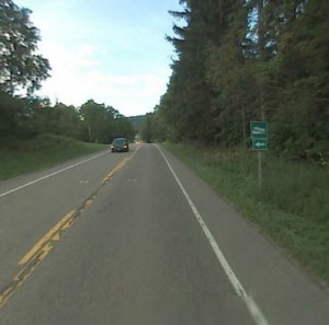
Heading north on 15A.  Parking area is on the left.

Heading north on 15A. Parking area is on the left.

From the Johnson Hill / Old Bald Hill Rd South / 15A intersection: Follow 15A South for 0.3 miles.  The parking area is on the right.

From Hemlock or Honeoye:  Follow 15A South for 8.4 miles from the 15A / 20A intersection south of Hemlock.  The parking area is on the right.

From Rochester: Follow East Henrietta Road (15A) south towards Springwater. 24 miles south of Rush, as you approach the south end of Hemlock Lake you will see a boat launch sign for Hemlock Lake. Take a right into the parking area directly off of 15A.

Posted on by

Wheaton Hill Trails – Directions

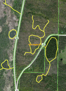
Wheaton Hill TrailsThe Wheaton Hill Trails are a half mile up Wheaton Hill Rd from Rt 15A,  If headed up the hill, the Pine and Skid Trails are on the left, the Spruce and Red Bud Trails are on the right side of the road.

From Springwater: Go north on 15A for 0.9 miles, and bear right on the first road, Wheaton Hill Rd (Co Rd 16).  The trail heads are a half mile up Wheaton Hill Rd.  There are clearings on both sides of the road for potential parking areas.

Wheaton Hill Rd at 15A

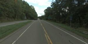
Street view looking south on 15A at the intersection with Wheaton Hill Rd on the left.

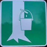
From Hemlock: Go south on 15A for 9.9miles for the intersection with 20A Hemlock-Honeoye Rd.  Take a sharp left turn on Wheaton Hill Rd (Co Rd 16).  You will see a sign for Tamarack Campgrounds and for Tabors Corners and a Maple Syrup sign. The trail heads are a half mile up Wheaton Hill Rd.

From East Springwater: Follow Tabors Corners Rd (Co Rd 36) north to the tee at Wetmore Rd.  Turn left (south) on Wetmore Rd, and then an immediate right on Wheaton Hill Rd (Co Rd 16). Follow Wheaton Hill Rd down the hill.  At 0.6 miles south of Canadice Rd, Wheaton Hill turns toward the left.  The trail heads are a tenth of a mile past the curve.

Posted on by

Sugarbush Hollow Sugarhouse – Directions

Directions to the Sugar House on Pardee Hollow Rd.

From Springwater: go North of 15A for .8mi from the light. Turn right on Wheaton Hill Rd (see the maple sign  ). At the tee, at the top of the hill, turn right onto Wetmore Rd. Bear right on Tabors Corner Rd. After 1.8 miles, turn left on Pardee Hollow Rd . Turn right at the tee to stay on Pardee Hollow Rd. Park on the east (left) side of Pardee Hollow Rd past Coates Rd just south of the Sugar House.
From Wayland: take Rt 21N for 5.6 miles. Turn left on Co Rd 38 (Garling House Rd AKA Rowe Rd). Take the first left onto Pardee Hollow Rd and continue for 3.2 miles. Park on the east side (right) of Pardee Hollow Rd just before of the Sugar House.
From Honeoye: take W Lake Rd south. Turn right onto French Hill Rd. At the tee (at Dug Rd) turn right to stay on French Hill Rd. Take the first left on Garlinghouse/Atlanta Rd. Go Right on Pardee Hollow Rd and continue for 3.2 miles. Park on the east (right) side of Pardee Hollow Rd just before of the Sugar House.

Posted on by

Rob’s Trail parking lot to the Canadice Lake trail head South – Directions

If you plan to hike from Rob’s Trail down to Canadice Lake and exit at the south end, use these directions to drive to the pickup point.

Turn left out of the Rob’s Trail parking lot.  Proceed south on Old Bald Hill Rd.  Just before the intersection with Rt 15A, turn left on Johnson Hill Rd.  Take the first left onto Canadice Lake Rd.  Park at the trail head 1.1 miles north on Canadice Lake Rd.