Posted on by

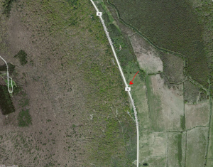
Hawk Haven (42.56828, -77.67880) – Directions

Hawk Haven (Ann and Rick Lafford’s home) is located at 6270 McNeil Hill Rd. Parking is at the dead end turn-around or in the driveway. 

From Main St Dansville: Heading southeast on 63 leaving town, turn left on Sahrle Hill Road for 1.3 miles. Turn left on Mendoleine Rd for 0.6mi to the top of the hill, then left on Sterner Rd until it turns into McNeil Hill Rd. Follow McNeil Hill Rd until the dead end. Rick & Ann’s home is on the left.

From Wayland: From Rt 15, take NY 63 North (compass direction is west) toward Dansville for 3.3 miles. Turn right on Whiteman Gully Rd for 0.8 miles and take the first right onto Mendoleine Rd. Turn left onto Sterner Rd on top of the hill.  After 0.7mi, continue straight on McNeil Hill Rd until the dead end. Rick & Ann’s home is on the left.

From Rochester: Take I-390 South to exit 9.  Turn left onto NY 15 toward Lakeville. After one mile continue straight onto NY 256 when 15 bears to the left. Follow 2565 for 19.1 miles past the full length of Conesus Lake.  Turn left on Reeds Corners Rd. Take the first right on Depot Rd, then the first left on Vista Hill Rd (County Line Rd) for 1.2 miles.  Take the first right on Kidd Rd and then right on McNeil Rd.  Rick & Ann’s home is on the left.

Elevation: 1538.05 ft
Latitude: 42.56828
Longitude: -77.67880

Posted on by

Schribner and Giles Roads (42.605,-77.541513) – Winter Directions

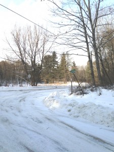
GilesRoadSignThese directions are being provided because Schribner and Giles are seasonal roads at the north west ends.  If you use your GPS, please be sure that you are coming up Schribner Rd from Tabors Corners Rd. Enter Tabors Corners. Then enter 8664 Schribner Rd.

From Springwater: Head north on Rt 15A from the light in Springwater.  Take the first right on Wheaton Hill Rd (Co Rd 16).  Turn right on Wetmore Rd at the stop sign at the top of the hill.  At the end of Wetmore, bear right on Tabors Corners Rd.  After 3.5 miles turn right on Scribner Rd.  The driveway is on the left one mile up Schribner Rd and about 10 feet before the intersection with Giles Rd. There is room for a few cars in the driveway, or turn around at the intersection and park on the the road.

From Wayland: From Rt 15, head east on Rt 21 toward North Cohocton for 3 miles. Turn left on Tabors Corners Rd (Steuben Co Rd 37).  After 2 miles, turn left on Schribner Rd (the second left).  The driveway is the 2nd driveway on the left one mile up Schribner Rd and about 10 feet before the intersection with Giles Rd. Turn around at the intersection and park on the west side of the intersection.

From Honeoye: From Rt 20A, head south on Ontario Co Rd 37.  At Canadice, continue straight ahead on Canadice Hill Rd as Co Rd 37 turns right. When Ross Rd bears to the right, stay on Canadice Hill Rd straight  ahead past Harriet Hollister Spencer Park. At the Springwater Town Line Rd, continue straight ahead on Wetmore Rd. Stay on Wetmore up over the hill to the end (total distance from 20A to the end of Wetmore Rd is 10.7 miles). Bear right on Tabors Corners Rd.  Turn right on at 3.5 miles on Scribner Rd.  The driveway is the 2nd driveway on the left one mile up Schribner Rd and about 10 feet before the intersection with Giles Rd. Turn around at the intersection and park on the west side of the intersection.

From the East Lake Rd in Honeoye or From Naples: Rather than traveling north to reach 20A or Co Rd 37, hikers from east of Honeoye Lake may go south to Ontario Co Rd 36 and follow Co Rd 36 to Naples. Turn right on Rt 21 south.  Turn right to stay on Rt 21 for 4.5 miles to N Cohocton.  Turn right to stay on Rt 21 towards Wayland.  After 3.8 miles turn right on Tabors Corners Rd (Steuben Co Rd 37).  After 2 miles, turn left on Schribner Rd (the second left).  The driveway is the 2nd driveway on the left one mile up Schribner Rd and about 10 feet before the intersection with Giles Rd. Turn around at the intersection and park on the west side of the intersection.

Finally, for hikers who enjoy maps, it isn’t clear whether Tabors Corners has one or two s’s and if only one where it goes.  Google Maps calls the road Tabors Corners Rd in Steuben Co and Tabors Corner Rd in Livingston Co.  Bing maps calls it Tabor Corners Rd. everywhere.  The Springwater town assessor’s rolls contains all three spellings.

You also may see Schribner Rd spelled without the h.  At one time the h was missing on the road sign at the Strutt St end, but that has been corrected.  The 1872 county atlas shows P. Scribner living just north of the intersection with Giles Rd. (Of course it is J Guile who lived on Giles Rd)

Posted on by

FLT Robinson Loops – Swain NY – Directions

The Loop hikes are east of the Swain ski area and will start from a parking area at the end of Mill St and across from the tubing hill.  Parking may be limited, especially during ski season, so car pools are recommended. 

Hikers are welcome to carpool from the Town Hall in Springwater or from the Municipal Parking lot on the right side of Clara Barton St (Rt 36) in Dansville across from Church St.  If you do not carpool, we will meet at Mill St in Swain. Since you may need to drive as part of the carpool, please bring these directions with you.

Carpools

Carpool from Springwater: meet at the Town Hall on Rt 15, 0.2 miles south of the flashing light. Please meet at 1:00 and be ready to leave promptly at 1:15 for Swain.

Carpool from Dansville: meet at the  Municipal Parking behind the Sunrise Inn at 1:15.  We will leave promptly at 1:30 and drive to Swain.

Directions to Swain

From Springwater: Take rt 15 south through Wayland to I360 N.  Turn right onto I390.  Take exit 4 (NY 36 Dansville).  Turn right on NY 36S for 6.4 miles. Turn right onto NY 70 N, for 7.4 miles.  Turn left onto Co Rd 24 and take the first left onto Mill St.

From Dansville: Head southwest on Clara Barton St (Rt 36) for 7 miles past Stony Brook Park.  Turn right onto NY 70 N, for 7.4 miles.  Turn left onto Co Rd 24 and take the first left onto Mill St.

From Rochester or Geneseo: Head south on Interstate 390.  Take exit 7 for Mt Morris.  Turn left at the end of the exit on NY 408 South for 1.9 miles.  Turn left on Main St and then the first right to stay on NY 408 S (Chapel St).  Follow 408S for 13.7 miles through Nunda.  At the flashing light turn left onto NY 70S.  Follow Rt 70 for 7.2 miles.  Turn right onto Co Rd 24 into Swain.  Take the first left onto Mill St.

Posted on by

Honeoye Inlet Parking Area – West Lake Rd – Directions

Honeoye Inlet Parking west lake rdDEC Parking Area on West Lake Rd CR-36 (Honeoye Inlet),
Canadice, NY 14471
42.689380, -77.500197

The parking area is a small area on the east side of the road.

From Honeoye:  From Route 20A head south on CR 36 for 7.2 miles. Parking is on the left side.

From Naples: head north on CR 36 for about 8.5 miles.  Parking is on the right side.

From Springwater: Head north of Rt 15A and turn right onto Wheaton Hill Rd.  Take the first left on Canadice Rd (Co Rd 42).  Turn right after 0.8 miles to stay on Canadice Rd (Co Rd 42).  At the county line, this becomes Ontario County Rd 37.  At the white church in Canadice, turn left to stay on Co Rd 37.  Take the second right on Jersey Hill Rd.  At the bottom, turn right onto W Lake Rd (Co Rd 36).  The parking area is on the left about 4.5 miles south of Jersey Hill Rd.