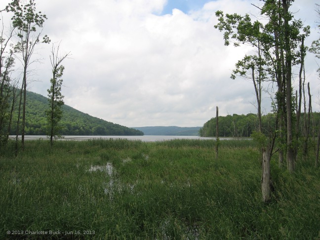
When you plan a hike, it is very useful to tell people how to get to the hike. This is very easy using Google maps, Bing maps or probably your favorite mapping website.
There are three ways to help people find the hike. Our most common is to write out turn by turn directions from Springwater and other towns. The second is to provide a link to one of the mapping websites and help get directions to the correct point. Third is to provide the GPS coordinates that can be entered into a car’s GPS. Providing all three allows each person to select the appropriate technology.
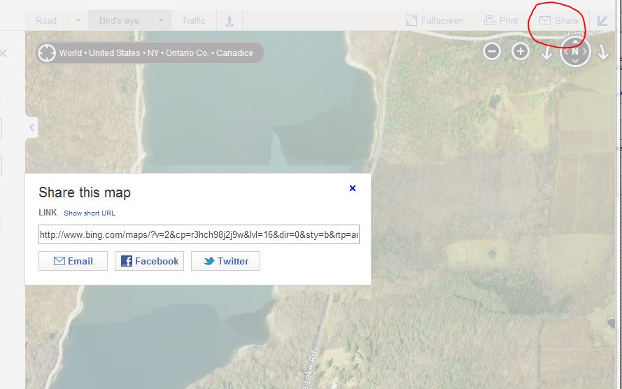
In Bing maps, click on Share to see a link.
Bing seems to be a little more obvious than Google for this task. Since Gene could not make the Google directions work, I suspect others also had trouble. So here are step by step directions for Bing.
- Browse to bing.com/maps.
- Enter an approximate location for the hike in the search box.
- Browse the map to find the exact spot where you want to meet. Use Bird’s eye (or click the dropdown to the right of Bird’s eye) to select aerial – find the best for you internet speed) to place the position exactly.
- Switch back to Road view. To get a GPS coordinates, click on the trail head and press the right mouse button. You can then highlight the grey area and press CTRL-C to copy the coordinates.
- Click on “Share” to get a link to this view. Click on “Show full URL” to get the detailed address.
- Highlight the link, press CTRL-C to copy and paste the link into an email.
Google Maps directions
Get a link to your Google Map.
The following directions for Google Maps work in the Chrome browser on Windows 7. It is probably similar for you.
- Browse to maps.google.com.
- In the search box, type the approximate location of the hike. For example, enter Springwater, NY.
- Browse the map to find the exact spot where you want to meet. Trail heads are usually visible on the Satellite view if you zoom in far enough. If you have a slow internet connection, you may want to get close using the Map view before switching to satellite view
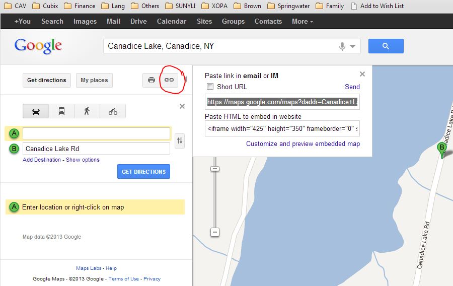
- Once you find the meeting spot, point to it with your mouse and press the “right mouse” button to get a context menu. Select “directions to here”.
- This will give you directions from the approximate location you entered to the real location. To help the person you are sending the link to, you can remove the approximate location by highlighting and deleting the From address.
- Click the “chain” icon (see the red circle in the picture above) and press CTRL-C to copy the link. Then paste the link into an email and send it off.
The link will look like https://maps.google.com/maps?daddr=Canadice+Lake+Rd&hl=en&sll=42.699674,-77.567296&sspn=0.011575,0.017424&geocode=FciWiwIdHHJg-w&t=h&mra=ls&z=16
Clicking on the link will show the map the way you had it. So this is a good way to share. Also, the longitude and latitude is right there (42.699674,-77.567296) if you have a GPS.v=2&cp=42.669683~-77.585483 &lvl=13&dir=0&sty=r& rtp=adr.~pos.42.702303_-77.566199 _near%206615 %20Canadice%20Lake%20Rd%2C %20Springwater%2C%20NY%2014560___a_ &mode=D&rtop=0~0~0~&form=LMLTCC.