
Purcell Hill Rd
Springwater
NY
1. Bring hiking poles if you want to hike up Rob’s trail. It could be very slippery.
3. Bring a chair for the social after
4. Check the weather and this website for rain related changes to the plans.
Be safe and stay dry.
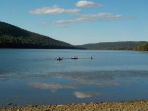 the northwest corner of Canadice Lake, at the Purcell Hill Road trailhead. It’s only a short distance up the hill from the intersection of Canadice Lake Road and Purcell Hill Road. Tourists and Naturalists can walk as far as they want along the lake shore, up to 6.5 miles if you go all the way to the south end, and return. If you have any questions about the kayak paddle or the hike location you can call Jim on (585) 880-0188
Climbers who would like more of a challenge can head up Rob’s Trail toward Route 15A.We’ll be working out this hike as we go because of the weather conditions this week – there has been a huge amount of rain, so if the conditions on Rob’s Trail are excessively muddy or slippery we’ll just turn around. This will be a there-and-back hike, and at it’s longest it adds up to almost 6 miles, with half of it easy level walking by the shore of the lake; the questionable part is when we leave the lakeshore and find the steep slopes at the beginning of Rob’s Trail.
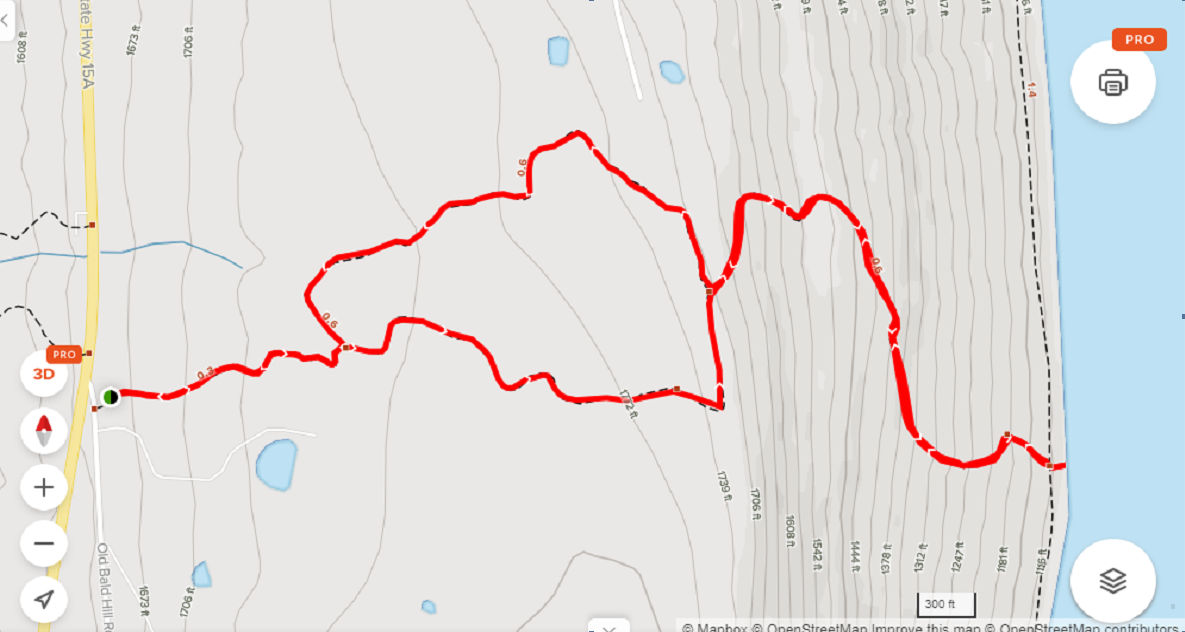
Directions to Hike:
From Springwater: Head north on 15A and make a right on Purcell Hill Road. The trailhead will be on your right in 1.2 miles.
From Canandaigua, Honeoye and Hemlock: Take Route 20A to the Canadice Lake Road intersection. Go south 3.4 miles to the Purcell Hill intersection. Turn right and go .4 miles. The trailhead will be on your left.
From Rochester: Take Route 390 south to the 5&20 exit, go east to Lima, then south on Route 15A. After Hemlock, turn left on Route 20A and right on Canadice Lake Road for 3.4 miles. Turn right on Purcell Hill Road and go .4 miles. The trailhead will be on your left.