
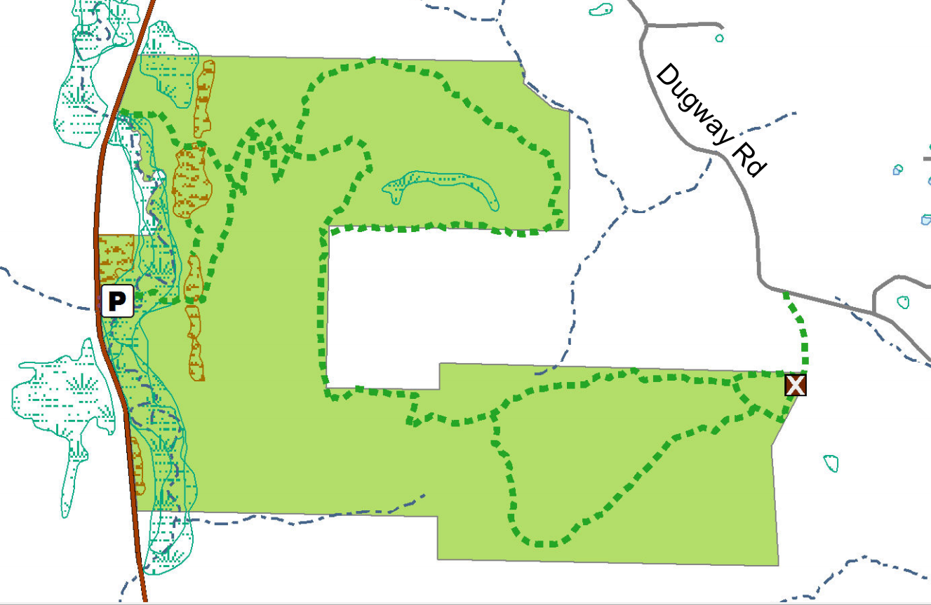
The Stid Hill Multiple Use Area is a 847 acre tract of land situated in the townships of Bristol and South Bristol in Ontario County. It is bounded by Route 64 on the west and Dugway Road on the north. Ganargua Creek, better known as Mud Creek, flows along Route 64. At one time, Stid Hill was productive sheep and cattle grazing land. Today the grazing has been eliminated. The mixture of steep hills, ravines, gullies, gorges, woods, and open areas create scenic vistas and also provide varied wildlife habitats.
We will meet at the Stid Hill MUA parking area on Rt. 64 at 1:45pm. Once we determine how many would like to hike the trail from top to bottom, we will leave some cars in this parking area. We will then carpool and proceed to drive up to the parking area on Dugway Rd. At this point the climbers will set out to hike back down to Rt. 64. The Tourists and Naturalists will follow the trails up at the top of the hill. The ground is uneven so you may want to bring poles. There are also very wet and muddy spots along the trail so waterproof hiking shoes or boots would be recommended. Rt. 64 runs north and south. If you are coming from the north starting at 5&20 head south, past Bristol Center and CR32, the parking area will be on your left. If you reach Bristol Mountain Ski Area, you have gone too far. From the south head up Rt. 64 past Bristol Mountain Ski Area, and the big wooden sign that says Stid Hill, you will see the parking area on your right.
Though the trails were well marked at one time, there hasn’t been much trail maintenance recently. The trail markers are difficult to follow and sometimes deceptive, and they disappear completely over the crown of the hill. The going will be very wet in places over the crown.
The Meeting Place
We will meet at the Stid Hill MUA parking area on Rt. 64 at 1:45pm.
Getting There
Route 64 runs north-south, so there are only two direction of approach.
From the north, (Honeoye and Bloomfield) starting at Route 5 & 20 in Bloomfield, come down Route 64. 3.0 miles south of Rt 20A and 1.4 miles past Bristol Center (and CR 32), turn left on Dugway Road. If you come to a Stid Hill MUA parking area, you’ve come too far south – turn around and try again.
From the south, starting at Bristol Springs for 6.4 miles, come up Route 64 past both Stid Hill parking areas, then turn right on Dugway Road. If you come to Bristol Center you’ve come too far north.
From Springwater, Google Maps recommends heading north to 20A through Honeoye, then south on 64.
From Wayland, the recommendation is to take Rt 21 through Naples to the east end of Dugway Rd (4.5 miles north of the intersection with NY 64). The trail head is 1.2 miles west on Dugway, (Dugway is paved to the Bristol/Canandaigua town line).
Dugway Road is a good dirt road. The trail head is exactly 2.0 miles from the Route 64 junction. It’s easy to miss – it’s just a widening of the road after a sharp left turn. The trail head is on the right of the road and marked with a discreet sign a little too far from the road. Please park carefully. There isn’t much parking space to be had.
The Social
We’ll go to Lock Stock and Barrel on Route 64 just north of Bristol Mountain for the social after the hike.