
Hikes led by Springwater Trails are generally held on Sunday afternoons and appear in this calendar in green.
| Sun | Mon | Tue | Wed | Thu | Fri | Sat |
|---|---|---|---|---|---|---|
| Sonyea State Forest-Keshequa Creek Hike 2:00 pm Sonyea State Forest-Keshequa Creek Hike @ Sonyea State Forest Hike Apr 7 @ 2:00 pm – 4:00 pm 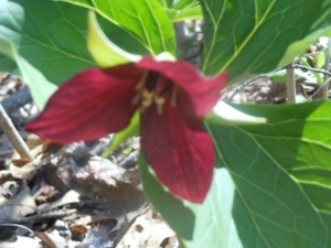 This Sunday, we’re returning to Sonyea State Forest in Livingston County, to hike along the Keshequa Creek and enjoy early spring flowers. We will meet at 1:45pm at the gate that marks the head of the Keshequa Creek Falls Trail … Continue reading | ||||||
| Charlotte-Genesee Lighthouse Tour and Hike or Bike Genesee Riverway Trail 2:00 pm Charlotte-Genesee Lighthouse Tour and Hike or Bike Genesee Riverway Trail Apr 14 @ 2:00 pm – 4:00 pm  Tour of Charlotte Genesee Lighthouse and Hike or Bike Genesee Riverway Trail A special treat has been planned for this hike date! We have been invited to tour the Charlotte Genesee Lighthouse BEFORE our regular scheduled hike time. For those interested in … Continue reading | ||||||
| Sandy Bottom Park Hike or Honeoye Lake Bike Ride 2:00 pm Sandy Bottom Park Hike or Honeoye Lake Bike Ride @ Sandy Bottom Park Apr 21 @ 2:00 pm – 4:00 pm  Come join us for a hike in Sandy Bottom Park and its adjacent creek, or a bike ride around Honeoye Lake! We will meet at 1:45pm at the parking area of Jack Evans Drive at Sandy Bottom Park, (which is … Continue reading | ||||||
| Harriet Hollister Spencer Recreation Area, Springwater-Hike 2:00 pm Harriet Hollister Spencer Recreation Area, Springwater-Hike @ Harriet Hollister Spencer Park Hike Apr 28 @ 2:00 pm – 4:00 pm Please join us this Sunday for one of our favorite hikes not far from Springwater! A few years ago New York State acquired several new parcels of land to the south of Harriet Hollister Spencer Park, linked to the main … Continue reading |
Please join us this Sunday for one of our favorite hikes not far from Springwater!
A few years ago New York State acquired several new parcels of land to the south of Harriet Hollister Spencer Park, linked to the main park by an established snowmobile trail called C4. In the past, we’ve hiked the section of the C4 trail closest to the main park, and this Sunday we will hike from the parking lot, following Ruthies trail, to Chalet trail to C4 trail. We will follow C4 to a point where we will turn onto a old single track hiking trail (red dashed) that crosses the “Sidewinder” trail through the south east section of the park. we’ll follow this around and return back to the parking lot via the single track trail (red dash trail) which runs parallel with the overlook road.
Wear proper clothing according to prevailing weather conditions . As always, bring water, poles, and good hiking footwear. The trail is gently rolling – no especially steep sections.
Optional Social: Please join us at the Birdhouse Brewing Company in Honeoye – 8716 Main Street, just east of the traffic light, for craft beer and pub food
Directions:
From Springwater and Wayland – take Route 15A North from Springwater, turning right on Wheaton Hill Road. Take a left on Canadice Road (County Road 42), forking to the right when County Road 42 divides off from Canadice Lake Road. Make the next right, on Tibbals Road (formerly Town Line Road). In 1.0 miles, Take the first left onto Ross Rd. At the stop sign (2.7 miles), take a sharp right onto Canadice Hill Rd. The parking lot will be on the left in 0.8 miles..
From Rochester or Canandaigua – go to Honeoye, and follow Route 21A (Main St. Honeoye) west toward Hemlock. About a mile out of Honeoye turn left on County Road 37. Follow County Road 37 until it makes a 90 degrees turn to the right across from the Canadice Methodist Church; at this point go straight onto Canadice Hill Road instead of County Road 37. Continue straight on Canadice Hill Road, taking the left fork at Ross Road, The parking lot will be on the left in 0.8 miles..
Please check back. More details about this hike to follow soon!
This Sunday we will hike the Finger Lakes Trail (FLT) starting at the Mt. Morris Dam and Visitors Center Parking Lot, as well as the Wildlife Loop Trail within the Dam property. We expect to enjoy the start of spring colors and, as we follow the east rim of the Letch worth gorge, the spectacular views of the gorge and Genesee River below.
The Wildlife Loop trail within the dam property is beautiful in its own right, with forest and grassy fields.
Three levels of hiking are planned – “Climbers”, “Tourist, and Naturalists”.
The Tourists will hike south on the yellow blazed (FLT) trail along the rim of the gorge, jogging east slightly away from the river across a boardwalk through a small wet area, stop at Hogsback Overlook to view the Hogsback formation of the river gorge, continue on the trail and after hiking 1 hour, turning around to head back. On the way back, we will follow the same yellow blazes but take the alternate orange blazed trail along the rim of the gorge which joins back up with the yellow trail, back to the parking lot. Total hike is 3.25 miles. Tourists may wish to walk the “Wildlife Loop”, once back to the parking lot.
The Naturalists may wish to walk the “Wildlife Loop” that starts to the right of the visitors center.
The Climbers who want a longer hike will carpool down to Lorenz Park in the village and pick up the Finger Lakes Trail and follow the yellow blaze markers south back up the gorge to the dam.
The Hike Assembly Point:
The Visitors Center will be closed. However, there is a bathroom adjacent to the parking lot that may be open on the day of the hike. All hikers will begin the hike at the Mt. Morris Dam Visitor Center Parking Lot. The trail access is at the west end of the parking lot (to your left as you face the gorge).
Social:
After the hike, all are welcome to gather at the larger pavilion located adjacent to the parking lot. Bring a dish to pass or a donation to the club fund would be appreciated, drink, and a chair.
Directions:
The Mt Morris Dam Visitor Center is about 45 minutes from Springwater, so please plan ahead. If you have a GPS, try entering Mt Morris Dam as your destination. Or enter Damsite Rd or 6103 Visitor Center Rd, Mt Morris.
From Springwater: Take Rt 15N and then left on Liberty Pole Rd. Stay on that road all the way to Rt63. There, take a left, and a quick right, onto Rt 258. At Rt 36, take a right and proceed to Mt. Morris. Turn left onto NY-408 South.
From Wayland: you can take I-390 north to exit 7. Turn left at the exit on NY-408 S to Mt. Morris. NY-408 goes left at Main St, then right on Chapel St.
From Hemlock and Honeoye: follow 20A West through Livonia and Lakeville to 390S. Exit at exit 7 NY 408 S to Mt Morris. Stay on 408 through Mt Morris.
From Rochester: Take I-390S to Exit 7 NY 408S. Stay on Rt 408 through Mt Morris.
From NY 408 in Mt Morris: Go south on 408 for 1.8 miles to Visitor Center Rd. Turn right at the Visitor Center Road and follow the road all the way to the Dam and Visitor Center Parking lot.
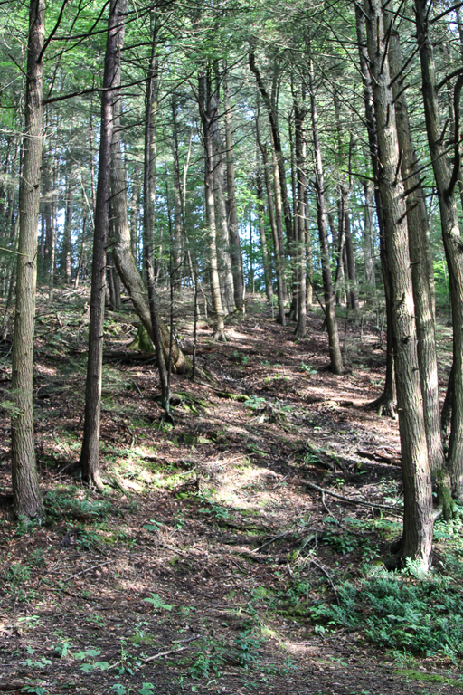
We will start from the trailhead on Bean Station Road, meeting at 1:45 for a 2 PM start. Following the orange blazes, we will head south past the restored Covell Cemetery and the Evangeline Shelter then climb steadily uphill through a hemlock and oak woods to the state forest and onto the top of the plateau. Tourists and Naturalists will go as far as the bog observation deck and then back track to Bean Station Road (~3miles total). Climbers will continue on past the overlook and follow the Bog Nature Trail Loop clockwise returning to Bean Station Road by way of the blue blazed side trail and then the main trail (~4.5 miles total).
Directions to Meeting Location
From Springwater: Head south on NY 15 to Wayland. Turn left onto NY 21, Turn left in N Cohocton to stay on 21 into Naples. Turn right onto NY- 53. Stay on NY-53 through Prattsburgh. Follow the directions below.
From Prattsburgh, take NY- 53 South for 2.6 miles to Bean Station Road. Turn east on Bean Station Road at the site of a large white warehouse for onions. Go 2.6 miles to the yellow trailhead sign on the right (south) side of the road at a little footbridge over the roadside ditch. Park on the north side of the road – this is important as this is a narrow road and parking on both sides could cause a traffic hazard.
From Geneseo and Dansville: Take I-390 South to I-86East. In 1 mile, take exit 37 for NY-53. Turn left onto NY-53 and head north for 8.9 miles. Turn right onto Bean Station Road. Continue with the directions From Prattsburgh.
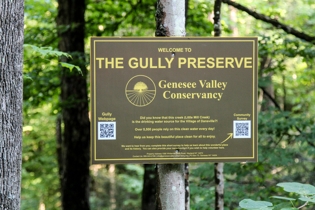
Whiteman Gully is a unique place – a pristine Finger Lakes gully not much touched by any organized hand. It was privately held until a couple of years, when it was bequeathed to the Genesee Valley Nature Conservancy.
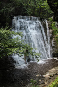
This is a different hike to our usual long walk; it will be a hike of exploration along trails which are not long, but unimproved and requiring care; we will wander around a small but very scenic patch of land. There are 3 trails to explore on both sides of Whiteman Gully Road. There have been few “improvements” to suit casual walkers on this property; if there has been rain recently the paths will be muddy but the waterfalls and the stream more impressive. To get a good view of the waterfall on the south side of the preserve there is a stream crossing on stepping stones to be dealt with, and the section of the trail to get a view of the waterfall is short but steep; this pattern is likely to be repeated on other trails that we explore. There are several waterfalls and a chute on the north side of Whiteman road, and further waterfalls can be seen which are probably beyond the boundary of the preserve.
The gully does not appear to have been farmed or logged and the trees are big and old.
The Meeting Place
We will meet at the point where Whiteman Gully Road in Wayland crosses the stream of the gully (42.55731, -77.65159). There is adequate roadside parking on Whiteman Gully Road. First we will explore the trail to the north west and the gully around the waterfall. We will then return to the meeting point and explore the trail upstream and finally the trail the the north west on the opposite side of the stream to the first trail that we followed.
All hikers will walk in just one group on this hike, and hiking alone is definitely to be avoided given the uncertainty of the trail conditions.
Equipment
Gum boots or high waterproof boots and two walking poles are strongly recommended for the stream crossing, especially if there has been rain, and the poles are generally helpful on muddy and steep ground.
We will bring a rope to help on the steep section of the trail near the waterfall
Directions:
From Naples: Come into Wayland on Rt 21 from the east. Continue through the two traffic lights when the road becomes Rt. 63 to Dansville. Passing the the Wayland school on the left, continue for about 3 miles to Whiteman Gully Road on the right. Turn right and follow the road for about half a mile; the road turns into dirt and drops downhill; the gully is at the bottom of the hill where the stream is marked by barriers along the side of the bridge.
From Springwater: Come into Wayland on Rt 15 and turn west on to Rt. 21, then follow the directions as from Naples.
From Dansville: Drive towards Wayland on Rt 63 and take the second Whiteman Gully Road left – Whiteman Gully Road follows an arc with both ends on Rt. 63 – then follow the road for about half a mile. The road turns into dirt and drops downhill; the gully is at the bottom of the hill where the stream is marked by barriers along the side of the bridge.
The Social
The social will be at the Sunset Family Restaurant in Wayland, NY.
Clothing required. Please check back. Additional information about this hike will be provided soon! Note time change for the hike.
Bee Pollination Tricks of the Trade!
Additional details to follow-please check back. Thank you.
Strike a Pose! Please check back with us. Additional details about this hike will be posted soon.
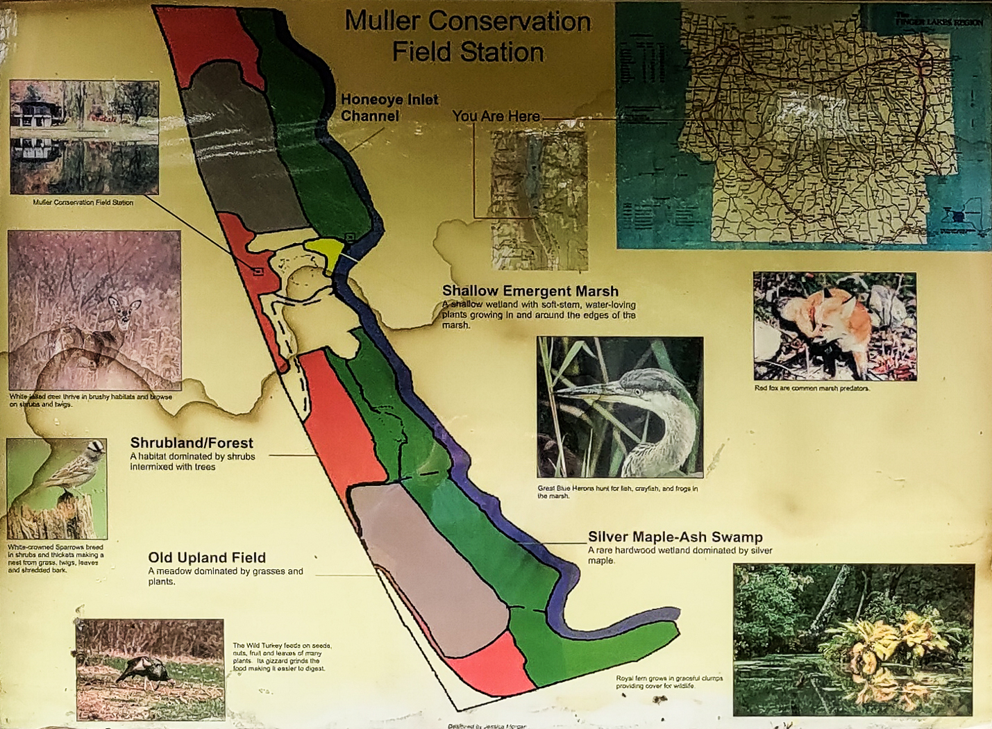
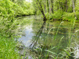
Muller family land at the south end of Honoeye Lake is now owned by the Finger Lakes Community College (FLCC) and it has expanded into a substantial research and conservation facility. It adjoins DEC land encompassing the rest of the south end of Honoeye Lake, and the FLCC and DEC have restored the water flow through the property and into the lake to salvage the ecology of the area. Springwater Trails has permission to kayak the inlet stream and to hike along it too.
We will do both on Sunday June 30, 2024. Meet and park in the lot at 3:45 at the Muller Field Station, 6455 County Road 36, Honeoye for a 4pm hike/paddle start. Come earlier if you want to use one of the Field Station’s boats, which are first come first served.
Beavers have done their work to adjust the property to their liking, and signs of beaver activity are plentiful. Tall invasive grasses dominate the trail borders and seasonal wildflowers are plentiful. Snakes are common and harmless to humans.

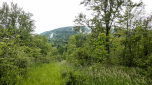
The hikers will follow the single trail following the inlet south in an out-and-back hike with each group turning back when they feel they should. The site director, Ally Esposito, will accompany the hikers and talk about the flora, fauna and the ecology of the property. There is a gate separating FLCC land from DEC land that can be walked around.The trail on FLCC land is mowed, but the DEC land tends to be more wild but sill very passable. In principle the trail goes all the way around the south end of the lake to the south boat launch on the east side but this hasn’t been tested yet.
The Muller Field Station and the Honoeye Inlet
The kayakers will put in at the luxurious boat launch close to the station complex. They will explore the inlet south as far as a very low bridge that effectively blocks passage by water, and will then turn back to see what’s downstream as far as the lake proper.
The FLCC has kayaks and canoes that are available to be borrowed; Please bring your own PFD if you want to take advantage of this.
Directions:
We will all meet at the Muller Field Station, 6455 Co Rd 36, Honeoye, NY 14471
From Rochester: Take Rt. 65 south to West Bloomfield, then crossing Rt. 20 take Rt. 37 south to Honoeye. At the junction with Rt. 20A turn left, then right at the lights in Honoeye on to Rt. 36 which is West Lake Road. Continue south on Rt. 36 for 5.6 miles; the Muller Field Station is through some imposing gates on the left side of the road. The gates are recessed and angled to the south so they are easy to miss from the north.
From Springwater: Take Rt. 15A south to Wayland, then turn left on to Rt. 21 to Naples. In Naples turn left (north) at the Middletown Tavern on to Rt. 36, also called Hunt Hollow Road. Continue north on Rt. 36 for 10 miles; the Muller Field Station is through some imposing gates on the right side of the road.
By GPS: Program in (42.71266, -77.51203) and follow directions.
The Social
The social will be a pot luck picnic at the Muller Field Station. Please bring a dish to pass if you are able.
Directions: The Field Station is at #6455 on the east side of County Road 36, a.k.a West Lake Road in Honeoye. From Honeoye, it’s 5.8 miles south from the traffic light at Route 20A in Honeoye. From Naples, it’s 9 miles north from Main Street; turn at the Middletown Tavern.
One thought on “Calendar”
Leave a Reply
You must be logged in to post a comment.
Looking for brochure.or mailing list so I can receive it in the mail.
Nothing opens up for mailing list.
There’s all kinds of very bizarre ads and post for viagra and other drugs above on calender page.
Please let me know if there’s a brochure available