
Wayland
New York
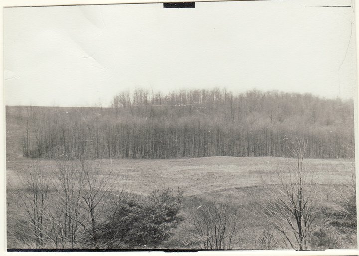
View across valley from main pond 1954.
It is nearly fall and we are taking that as a good reason to have a party. So join us on Sunday for a hike around Schribner Valley following by a campfire social. Fall wildflowers are out and the trees are still green so we will be hiking across fields and through the woods. Climbers will enjoy plenty of elevation changes, while Naturalists will take more gradual climbs to enjoy both sides of the valley.
We will meet at 3:00 at the house. The plan is to hike for 2 hours and then meet for an outdoor social around the campfire. We will grill hamburgers and hotdogs or sausage. You are welcome to bring a dish to pass or vegetables to cook. Also bring a chair and your preferred beverage. We will have bocce ball sets and kayak races on the pond for anyone interested.
Climbers and Tourists will head south along the creek. The trail will pass through a natural White Pine forest and next to a planted Norway Spruce forest. We will head down to cross the creek and head up to the top of the hill. Here, the trail will pass between a mixed planted forest (primarily Red Pine) and a Larch forest that was planted in the 1950’s and harvested in 2017.At the end of the Larches, we will enter the hardwood forest and climb as time and interest allow. Returning back to re-cross the stream, we will explore the oldest Red Pine forest on the property (planted in the 1930’s) to emerge into two fields that are deliberately being kept free of trees. The late season wild flowers are on display. We will continue around the fields and through the woods bordering them. A quick spin around the upper pond will return us to the cars.
Meanwhile the Naturalists will do the same hike in reverse, with more emphasis on flower and tree identification.
Social. A picnic social and campfire will start at 5:00 after the hike. Bring a dish to pass, a beverage and a chair.
We want to make a special invitation to all Springwater Trails alumni to come and join us for the social at 5:00 and catch up with old times.
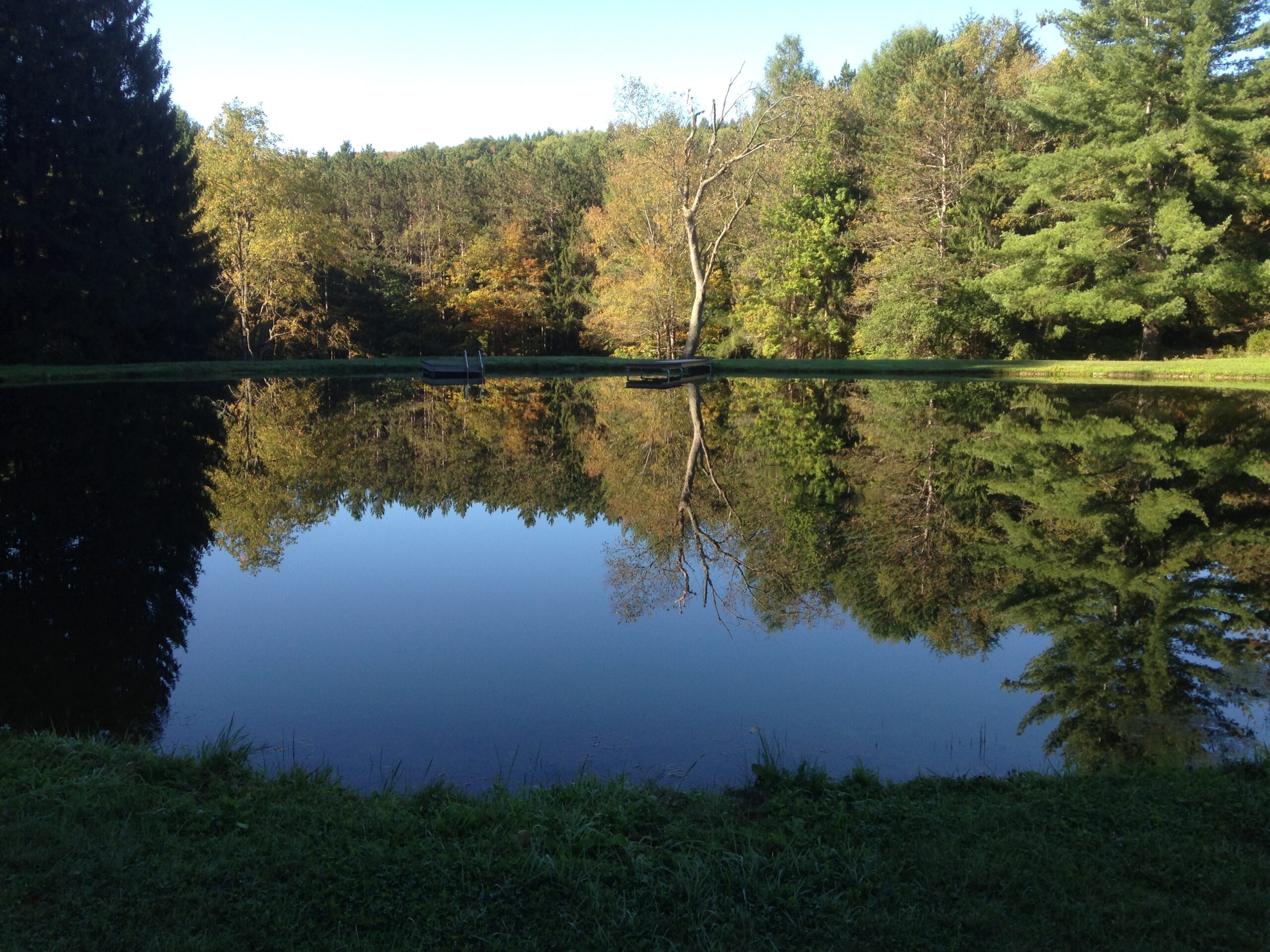
The current view across the pond. The hill and forest in the image above are now hidden by new trees.
Directions: If you use your GPS, please avoid Schribner Rd from Strutt St. The road will shake up your car. Take Giles instead. Our driveway is just below the intersection of Giles Rd and Schribner Rd. Enter the driveway and drive onto the grass to park up against the side of the barn.
From Springwater: Head south on Rt 15A from the light in Springwater. Take the first left on Marvin Hill Rd. Bear right at the Y onto Strutt St. Continue straight onto Quanz Rd when Strutt St bears right. Quanz Rd is a dirt road. Stay on Quanz Road past Fox Rd. Take the first left turn after Fox Rd onto Giles Rd. (0.7 miles from Strutt St). Follow Giles Rd to the intersection with Schribner Rd. The driveway is on the right about 10 feet past the intersection with Schribner Rd.
From Wayland: From Rt 15, head east on Rt 21 toward North Cohocton for 3 miles. Turn left on Tabors Corners Rd (Steuben Co Rd 37). The large sign on Rt 21 says Bowles Corners.After 2 miles, turn left on Schribner Rd (the second left). The driveway is the 2nd driveway on the left one mile up Schribner Rd and about 10 feet before the intersection with Giles Rd.
From Honeoye: From Rt 20A, head south on Ontario Co Rd 37. At Canadice, turn right to stay on Co Rd 37. Bear left to stay on County Rd 37. Turn left at the stop sign at Canadice Lake Road. Follow Canadice Lake Rd for 2.7 miles to the third stop sign. Turn left onto Marvin Hill Rd. Bear right at the Y onto Strutt St Continue straight onto Quanz Rd when Strutt St bears right. Quanz Rd is a dirt road. Stay on Quanz Road past Fox Rd. Take the first left turn after Fox Rd onto Giles Rd. (0.7 miles from Strutt St). Follow Giles Rd to the intersection with Schribner Rd. The driveway is on the right about 10 feet past the intersection with Giles Rd.
From the East Lake Rd in Honeoye or From Naples: Rather than traveling north to reach 20A or Co Rd 37, hikers from east of Honeoye Lake may go south to Ontario Co Rd 36 and follow Co Rd 36 to Naples. Turn right on Rt 21 south. Turn right to stay on Rt 21 for 4.5 miles to N Cohocton. Turn right to stay on Rt 21 towards Wayland. After 3.8 miles turn right on Tabors Corners Rd (Steuben Co Rd 37). After 2 miles, turn left on Schribner Rd (the second left). The driveway is the 2nd driveway on the left one mile up Schribner Rd and about 10 feet before the intersection with Giles Rd.
From Rochester: You may take your choice by going to Wayland, Springwater or Naples and following the directions from there. Rt 15A from South Ave in Rochester to Springwater is very easy, as is I-390 South to Wayland (Turn left when you get off I-390 and follow Rt 21 to Wayland).
From Fairport and Pittsford, we go through W. Bloomfield, picking up Co Rd 37 south of Rt 5 & 20 At Canadice, turn right to stay on Co Rd 37. Bear left to stay on County Rd 37. Turn left at the stop sign at Canadice Lake Road. Follow Canadice Rd for 2.7 miles to the third stop sign. Turn left onto Marvin Hill Rd. Bear right at the Y onto Strutt St Continue straight onto Quanz Rd when Strutt St bears right. Quanz Rd is a dirt road. Stay on Quanz Road past Fox Rd. Take the first left turn after Fox Rd onto Giles Rd. ().7 miles from Strutt St). Follow Giles Rd to the intersection with Schribner Rd. The driveway is on the right about 10 feet past the intersection with Giles Rd.