
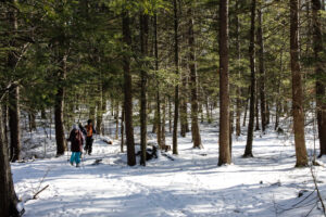
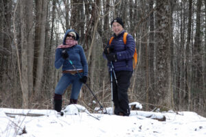
A hike through the Mitchellsville Gorge.
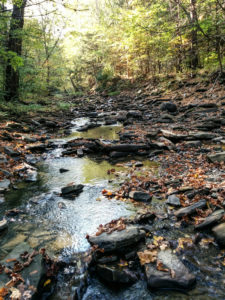
The hike on Sunday 7th August 2022 will follow a section of the main path of the Finger Lakes Trail in Urbana, just south of Hammondsport. It’s an easy hike of about 3.5 miles, and it follows the rim of a deep gully cut by the Mitchellsville Creek. This section slopes gently downhill from north to south with just a few short steep sections. The northern two thirds passes through a dense hemlock wood, and the path is a soft bed of hemlock needles; there are views of the deep gully along the way. There are two ‘beauty spots’ along the route; about a third of the way from the top there’s a short side track that juts out over the gorge giving good views from a height, and about two thirds of the way down there is a pretty creek. Unfortunately, we can’t get too close to either spot; this section of the trail is on private land and we can’t wander off it. The gorge overlook is crumbling and is dangerous, and access to the creek is specifically denied by the land owner.
A hike through the Mitchellsville Gorge.
We will meet at the FLT trail head on Route 54 in Urbana, by the Pleasant Valley Inn (42.388729, -77.260357) at 4:00pm.
The Climbers will shuttle to the high point of the hike at FLT access point 5 on Mitchellsville Road (42.404269, -77.290893), and then walk down the FLT back to the meeting point.
The Tourists and Naturalists will start at the meeting point and walk up the trail. They will walk a short distance north on Rt. 88 (it is Hammondsport-Pleasant Valley Road) and then go left on the FLT through a vineyard. At the end of the vineyard the trail crosses a stream and then rises up through the gully to a pretty spot by the creek. There are no steep sections on this stretch. Those who want to can carry on up the trail can do so, but there are some short but more difficult sections to navigate.
The Social
We’ll have a social at the Pleasant Valley Inn, next to where we meet for the hike.
Directions
From Honeoye: Follow W Hollow Rd (County Road 36) to Naples. Turn Right at the Middletown Tavern on to Rt. 21 South, and then bear left on to NY-53 South. Continue for 17.1 miles through Prattsburg and then turn left to County Rd 13/Mitchellsville Rd in Wheeler. Continue along Mitchellsville Road until you see the white church in Mitchellsville and then turn left in front of the church on to County Road 89. Turn right when this road ends and follow this road (County Road 88) to its junction with route 54. The parking area and trail head is on the left.
From Naples: Take NY-21 South, and then bear left on to NY-53 South. Continue for 17.1 miles through Prattsburg and then turn left to County Rd 13/Mitchellsville Rd in Wheeler. Continue along Mitchellsville Road until you see the white church in Mitchellsville and then turn left in front of the church on to County Road 89. Turn right when this road ends and follow this road (County Road 88) to its junction with route 54. The parking area and trail head is on the left.
From Rochester: Take NY 15 south to the I-390, and then I-390 South to the NY 54 / Bath exit, then follow NY54 north to the Pleasant Valley Inn. The parking area and trail head is on the left.
From Springwater and Wayland: Take 390 South to the NY 54 / Bath exit, then follow NY54 north to the Pleasant Valley Inn. The parking area and trail head is on the left.