Not sure how it occurred to me but it did. Perhaps it was the quantification and New Zealand article that Marty wrote, and perhaps combined with other impetus. Anyway here’s the numbers thing.
 Generically stated, there are 52 weeks in a year, so 52 Sundays or maybe even 53 sometimes, but never 54 in case your were wondering. Most of those Sundays have a Springwater Trails hike planned although we do take some holidays off. We at S/T maintain a hiking schedule of Four Seasons (remember Vivaldi?) each Season containing 3 calendar months (quarters) and 12 or 13 Sunday Hikes. Our Vice President and the Seasonal Coordinator start planning a schedule 2 and 1/2 months prior to the season. They are looking for a Hike Planner for each of the Sunday hikes. And since we have three groups of hikers, each needing a Hike Leader, the planner will recruit two additional Hike Leaders.
So lets figure, “round figures” of 52 S/T hikes/annum or 13 hikes/quarter. Maybe I am a bit on the high side of 50, but I am OK with that liberty. Do you have your spreadsheet out: 4 seasons with a coordinator for each season. 13 hikes per quarter with 1 planner and 2 more hike leaders. Add it all up, 4 coordinators, 52 planners and 104 leaders – so a year of hikes requires 160 volunteers!
On average, how many times do you need to volunteer? By arithmetic definition “average” can be: Mean, Median or Mode. Likely, some hikers are now scrambling for that high school math text book some still have boxed in the basement, attic, or elsewhere, or are pondering looking up a definition on the internet, but never-mind that. (Likely a dictionary will do for a refresher course if you really feel such necessary.)
Anyway, S/T has many hikers: a core group who are regular hikers, another group who frequently join the hikes, and yet another group who occasionally take the opportunity to hike. I will not attempt to quantify nor qualify number of hikes per annum assigned to each of the three frequency groups I have enumerated although hikers that come to 20 or more hikes are rewarded with a year membership in Springwater Trails.
 S/T usually has 12-20 hikers per hike, some higher and some lower than that range. I will chose on the low side, say 13 hikers per hike, for purpose of some calculations. With an average of 13 hikers per hike, that would mean 169 person-hikes completed per quarter or 676 hikes a year. Which brings us to the crux of the matter. Divide 676 by 160 and you find that every 4 and a quarter person-hikes is completed by a hiker who has volunteered to help plan or lead a hike. Or divide 676 by 52 and you will see that on average a hiker needs to plan one hike for every 13 hikes that hiker completes.
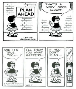
I offer this perspective because it is not unusual for S/T or other surrounding area hiking groups to be in need of hikers willing to Plan hikes. Without hikes being planned there is no hike. (There is an equation “No Plan” = “No Hike”). We have occasionally had no hike planned in a given week and as the week approached a S/T hiker decided the need existed and stepped up last minute to Hike Plan an “impromptu added to the schedule” hike. Great! Better yet though is if we can fill a seasonal hike schedule, with Hike Planners/Hike Plan locations from git-go before the season ever starts.
If only the core group of 13 regular hikers who hiked more than 20 hikes volunteer to plan hikes, it is clear that each hiker would need to plan one hike per season. Even if we factor in more hikers than a core group of 13, likely many hikers will need to Hike Plan three hikes in a year to fill the annual Hike Schedule. If you are a core or frequent S/T hiker consider these stats.
If you are an occasional S/T hiker or an infrequent S/T hiker also consider these same stats, and consider planning one or more hikes per year. To simplify the numbers, for every 10 hikes or part thereof that you hike, if possible, a contribution of Hike Planning one hike would be greatly appreciated by all S/T hikers. Thus if you hike up to 10 hikes/annum consider Hike Planning one hike for S/T.  If you hike 11-20 hikes/annum consider Hike Planning two hikes for S/T, etc.
Likely even with this mindset of contribution, not all hikers will always contribute such even though they may want to. We all experience life pulls us in different directions at times, and despite our best intentions we sometimes do not get to do certain things we want to or intend to do. (Thus the herein suggested Hike Planning mindset in not incumbent upon any hiker, just a suggestion and consciousness raising effort.)
Any hiker should also consider that we have had several instances where we have had a S/T hiker Hike Plan a hike, and not be able to have benefit of personally hiking the hike on “Hike Day” but yet provided the Hike Plan to other S/T hikers and was covered in leadership by turning the Hike Plan specifics over to another experienced Hike Planner. So unique opportunities exist as demonstrated based on past experience, you may also create some unique new opportunity.
 Hike Plans can range from simple to elaborate, and the more complex plans can contain many detailed components. As a Hike Planner, you can choose how you design the Hike Plan. I also note, some Hike Plans have been a collaboration of more than one Hike Planner, whether it be all collaborating on much of the Hike Plan, or perhaps certain components being handled by just one Hike Planner per component. And those collaborations may include experienced Hike Planners and/or New Hike Planners.
Yet further, I note many of the frequent S/T hikers have leadership roles and/or responsibilities they fulfill in S/T that are well outside of the role of Hike Planners, so not depending on each of those leaders for four Hike Plans per annum (and sometimes more based on past situations) would be a good thing.
Above all else with mindset of Hike Planning within S/T, you are not alone when you agree to Hike Plan, if you need help of any kind you merely need to ask for it. If you feel you need mentoring as a new Hike Planner, that support is there amongst your S/T hiking comrades, you may even ask for a Hike Co-Planner if you wish. And know this, even the most experienced Hike Planners and “retread hikes” likely have some consult with other Hike Planners in the planning of such.
 My point, when looking at Hike Planning as a quantification, don’t be shy to benefit us all by Hike Planning. Opportunity knocks for hike planning in four seasons. Consider answering the door. Hope to continue to see you on the trail.
I’m Just Sayin’.

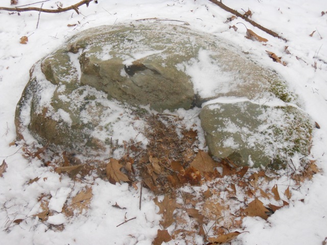
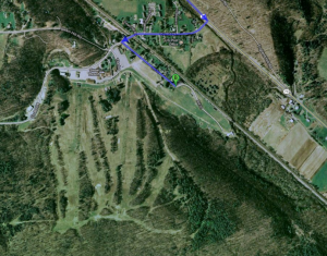
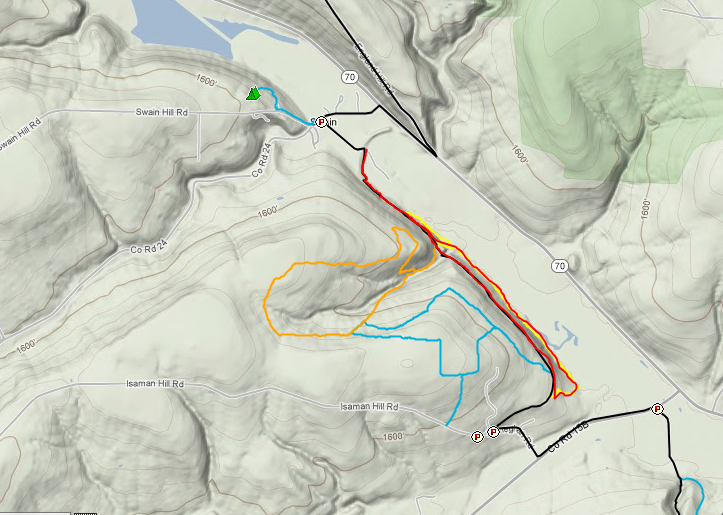
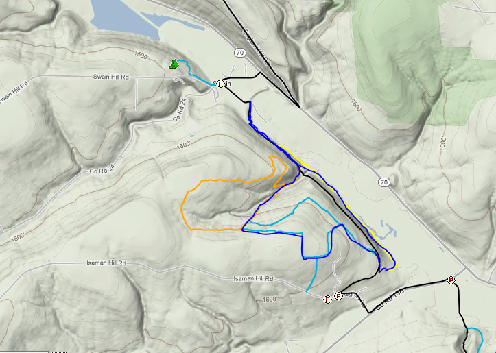
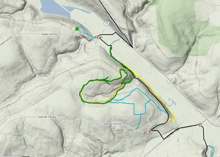
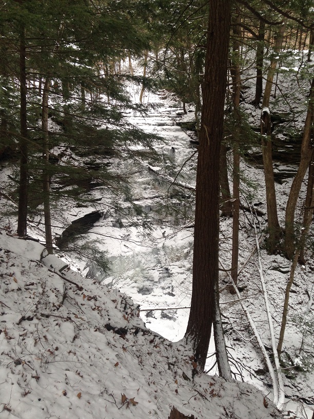 Using a dog rope, Mark and others assisted hikers to climb up the embankment next to a waterfall at the county line, as others searched for an alternative route, sometimes crawling and using the assistance of trees. At one point Mark and Char decided to slide down the hill together, knocking each other to the ground. Other hikers drove or walked to Johnson Hill Trail to start their hike on more flat terrain. The highlight of the ice covered waterfall was worth every minute of the slippery uphill hike. Hikers took time to admire and photograph, being careful not to get too close to the edge. Next time a rope will be tied to Wil and Wade for their bravery. This area is known for unexpected accidents and hikers being Mercy flighted out of this remote area.