Rare sight in sky

When night comes, and it’s too dark to hike,.there is still some nature to learn.  That’s the time when you can see what else is in our solar system, galaxy and universe.  Around the end of this month, there will be a once in a lifetime sight in the western sky.  This is a close grouping of the planets Mercury, Venus and Jupiter.  Using binoculars, or a telescope, you will be able to see all 3 in your field of vision.  You will easily be able to identify them by their comparative brightness.

Venus is the brightest one, due to the reflection of the sun from the sulfuric acid cloud that always surrounds this planet.  It is the brightest object in the sky, after the sun and moon.  Nothing else even comes close.  Once you recognize it, you will know it for life, every time it’s in the sky.  Jupiter is the second brightest, slightly brighter than some of the brightest stars.  Mercury is the dimmest one but, you should still be able to see it if you’re in a dark area, or through binoculars.

The trio will be the most compact on Sunday, May 26.  The best time to see them, is about 45 minutes after sunset, around 9:20.  Go where you have a clear view of the western horizon.  Look slightly to the north, just above the horizon.  You can also see them a few days before and after Sunday, if you have a clear night.

Because it’s close to the sun, Mercury is seldom seen.  When it’s in the night sky, it’s close to the horizon and, as previously mentioned, not conspicuously bright, so, this will be a good opportunity.  The last week of this month, it will actually be higher than Venus, and in the same field of vision.

Because they are inferior planets, Mercury and Venus appear in the western sky in the evening, or in the eastern sky in the morning.  In a telescope, they can be seen going through phases, like the moon.  The superior planets, Mars, Jupiter and Saturn, can be in any part of the sky.  Over 60 moons have been discovered around Jupiter.  In a telescope, you can see the 4 large ones, that Galeleo saw, and named.  Saturn, with its rings, and large moon, Titan, is now visible in the eastern sky.

Also, this week, you have a good opportunity to learn about our sun, and other stars like it, by watching the PBS science program, Nova, this Wednesday (5/22), at 9 PM, on WXXI.

Bristol Trail, Sunday May 26, 2013 – 2 PM – (42.6863,-77.417)

Roll out those lazy, hazy, crazy days of summer.  Those days of soda and pretzels and beer.

Hey climbers, feel up to a good vertical challenge, with a great view at the top?  Oy, do we have a hike for you!  The horizontal distance is only 3.2 miles but, don’t let that fool you because the vertical is about 600 feet, and steep, first up, then down.  If this is for you, then follow Jerri in a carpool, from the meeting area south, then right on Clement Rd.  You will see a sign for the south entrance to Camp Cutler, where you can park a few cars.  Then, a short walk west, past a black mailbox, to a post with 2 vertical orange blazes, is your trailhead.  The trail is well marked with orange blazes and Jerri, and her sweep, will be provided with maps.  Your hike will end at our meeting place lot.  Just one bit of bad news.  The hike is through boy scout Camp Cutler and state regulations prohibit dogs in children’s camps.  Mac and Duffy won’t be on this hike so, don’t tell them, or they won’t love me any more.

So, if this climb isn’t for you, or if your poochie makes you an offer you can’t refuse, then carpool to Ontario County Park, Take the park road to the west side, where you will see several parking areas near the “Jumpoff” sign.  Follow the orange blazed trail, to the meeting lot, about 3 miles.  Leaders will have maps.  It’s mostly downhill, and gradual, with an interesting beaver pond near the end.  When you get to CR 33, you will need to walk a short ways north to get to the lot. If there is anyone who would rather not do this hike, I will be glad to lead a nature walk on the park trails where we will try to identify birds, flowers, trees, or whatever we may encounter.

Festivities will start at 2 PM in our meeting place, the large parking lot by Access 2, on CR 33.  From Main St. in Naples, look for the Bristol Valley Theater and fire station, on the west side.  Turn on the street going west, then, an immediate right.  Carefully follow the green CR 33 signs, turning where indicated, and proceed on 33.  When you pass Porter Rd, on the right, you have 1.2 miles.  A glance to your left will show you the climber’s hill.  When you see a dark red barn on yourt right, slow down.  The parking lot, where we’re meeting, is on your left.  We’ll try to have our sign out around 1:30.

After our enjoyable hikes, bring your soda, pretzels and beer to pavillion 4, in Ontario County Park.  Our generous social committee has rented a covered pavillion, in case any of you tried to feed margerine to Mother Nature.  There are 3 picnic tables under the pavillion, and 1 outside of it, where we can put our food, if it isn’t raining.  Should be enough seating but, wouldn’t hurt to bring a lawn chair.  There is also a grill and we’ll bring a bag of charcoal, in case any of you would like to use it.  From the parking area mentioned above, walk down the road blocked by the huge rock.  Turn to your right and look for the most cheerful group in the park, by the second pavillion.  There is a water faucet nearby and, if there’s a need for relief, plumbing facilities are a short walk away, as well as lots of trees.

You’ll wish that summer would always be here.

Directions: Please view the Google directions here.

Rattlesnake Hill

21 hikers and 5 dogs

21 hikers and 5 dogs

You would be extremely lucky if you could find the location of yesterday’s hike again at Rattlesnake Hill. Carol hid it well as we followed her and Pati through dusty back roads into the back country of Ossian in what looked like a scene from “Deliverance”. Mark and Linda were tied up but eventually found us!    Getting a somewhat late start, 21 hikers and 5 dogs began their hike at Trail #18 & #19 into an area that is rumored to harbor old quartz mines. Although Carol has already mined all she could find for her special role in the future, all we could find were good patches of wild geranium and miterwort and of course a beautiful walking trail.Rattlesnake Hill

climbers passed through a meadow

climbers passed through a meadow

Hikers used their creativity to build directional signs so others wouldn’t get lost at the turns. They passed by a beautiful ridge, fields, and dense forests.

hiking 155

ridge trail

ridge trail

large patches of wild geranium

large patches of wild geranium

After hike social enjoyed shrimp, maple butter, watermelon, hot dogs and many other great salads beside a beautiful pond setting.  Thanks to Mark and Linda for transporting the very large grill and Carol and Pati for planning the hike. Bob keep working on the Garmond!  Suggestions for the future:  don’t wash your cars before a hike!

large patches of mitorwort

large patches of miterwort

social by pond

social by pond

Canadice Outlet Hike

old Dixon Hollow Road

old Dixon Hollow Road

Hikers experienced what it meant to “bushwack” and “cross a creek” this past Mother’s Day as they explored the Canadice Outlet  into the DEC Hemlock/Canadice State Forest.  Hikers split at the creek where the old steel bridge once spanned the outlet, one group taking the high ridge trail to find the Canadice Hollow cemetary and the other taking the low trail along the creek into the historical village called Dixon Hollow.  All hikers experienced a truly memorable hike, full of stories, laughs, and hopefully an “outward bound” adventure.

Char's pictures 063

jack in the pulpit

Jack in the pulpit

The water of the creek was somewhat low this time of year and tourists got their feet wet as they crossed the creek by either rope, stones, or downed trees into the historical hamlet called Dixon Hollow in search of the Mather family homes and mill.   Old foundation remains of bridges, mills, and houses were explored along a small foot path following the old Dixon Hollow Road. Wild violets served as a snack along the way, and periwinkle, fringed polygala (an orchid like flower), jack-in-the pulpits, wild geraniums, true and false solomon seal, blue cohosh, bloodroot and trilliums were plentiful in an area that has been untouched for over 100 years. Much to Marty and Don’s surprise, the Mather homestead was located and surrounded by an unidentified plant. A broken cement dam helped the tourists to locate the old Mather mill which was dismantled and relocated to Clay Street in Hemlock in the early 1900’s. For more information look up Dixon Hollow, Hemlock, New York.

myrtle or periwinkle

myrtle or periwinkle

Char's pictures 067

old well dixon hollow
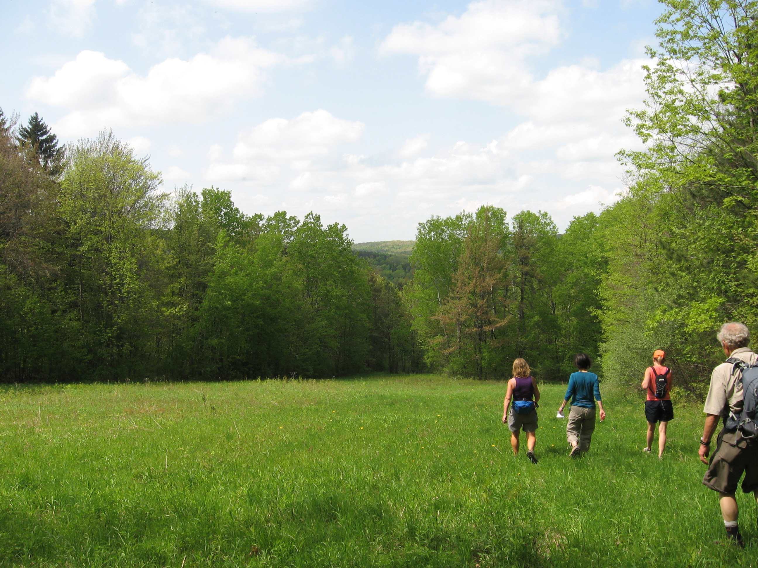
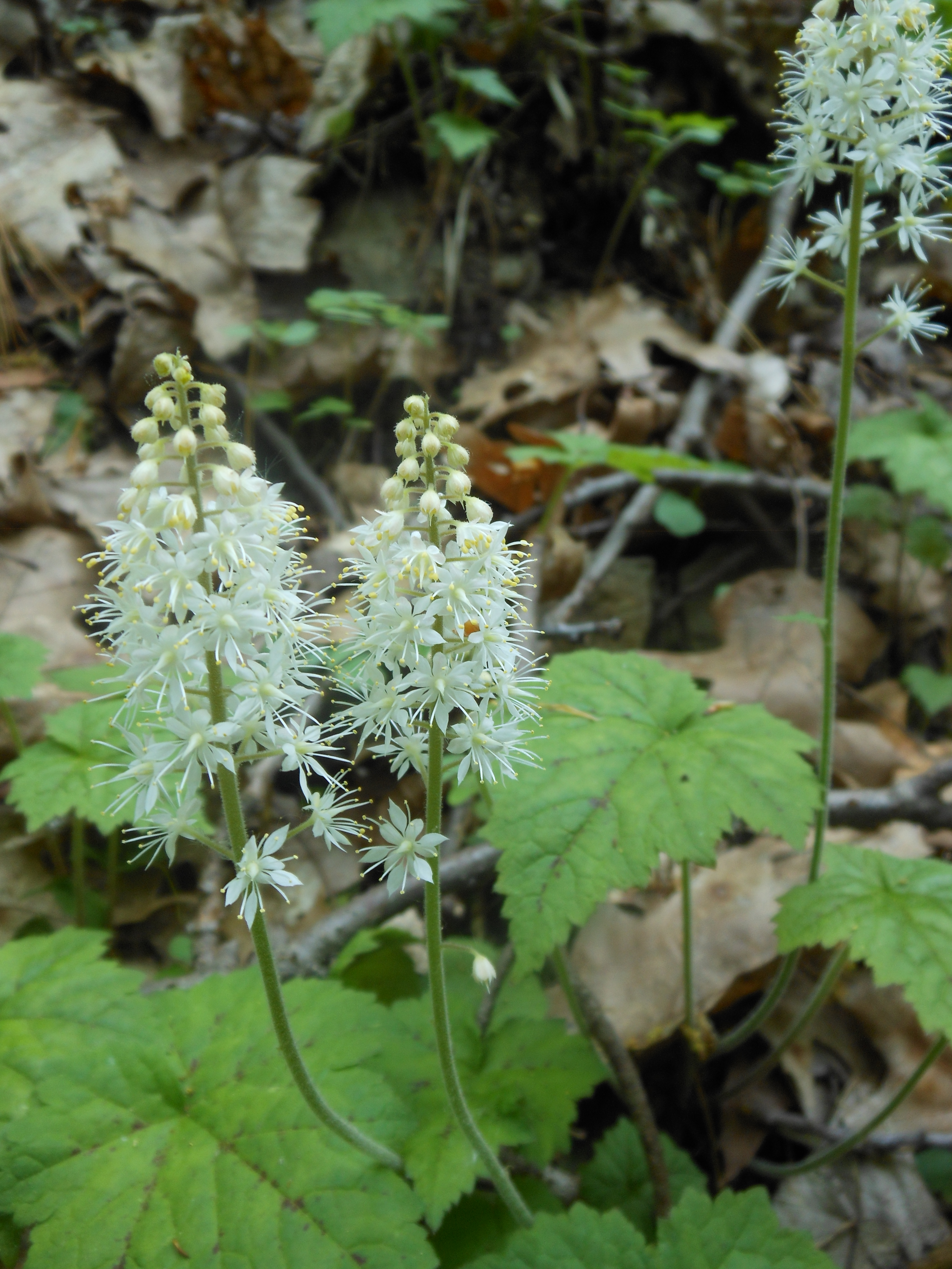
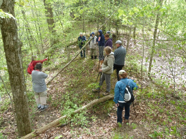
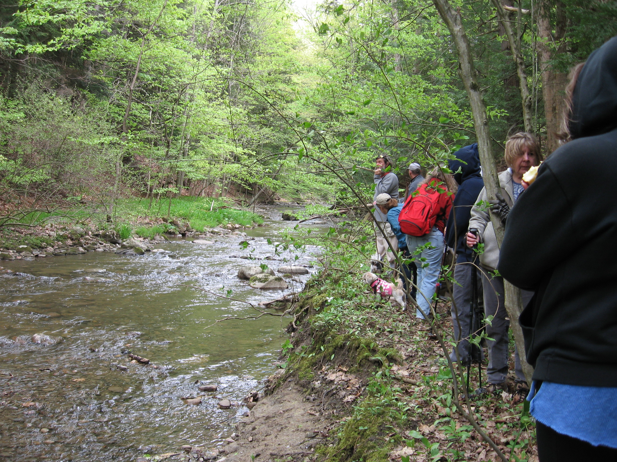
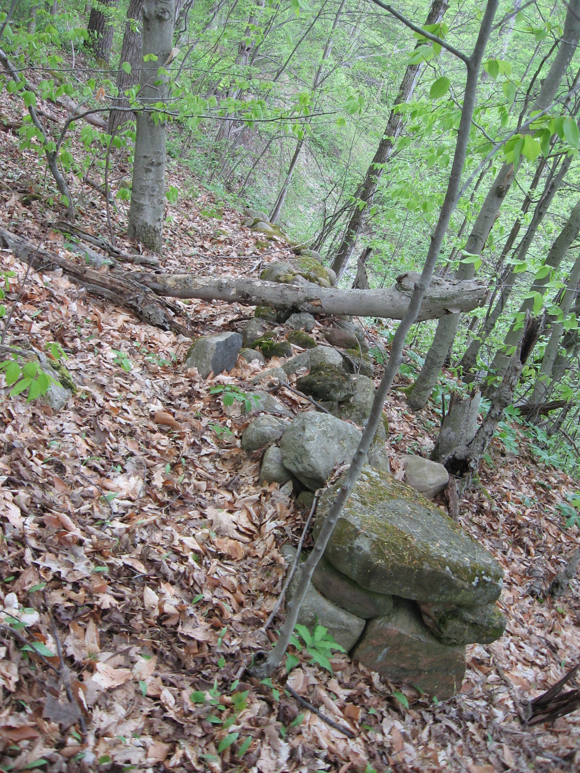
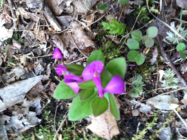
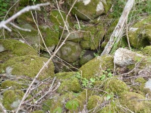
The climber hikers explored the high ridge on the west side of the Canadice Outlet Creek.  Using GPS coordinates, their destination would take them into an unknown area to locate the logging trail next to the Canadice Hollow cemetary. Everyone craved for Pati’s apple when they finally came upon the logging trail after smelling bear odors, finding an old open well and foundation, and crawling on their hands and knees through a dense multi-flora rose patch. With some help from trail builders and maintenance workers this path could serve as a great connection into the Canadice Outlet area.

Thanks go out to neighbor Todd for helping to lead the Naturalists and Pam for hosting the after hike social which included dandelion blossom drink and samples of other wild edibles, maple pulled pork, strawberries, and hiker dishes to pass.  Welcome to our new hikers, and the return of Marty and Amy!


Fringed polygala gaywings

Fringed polygala gaywings