
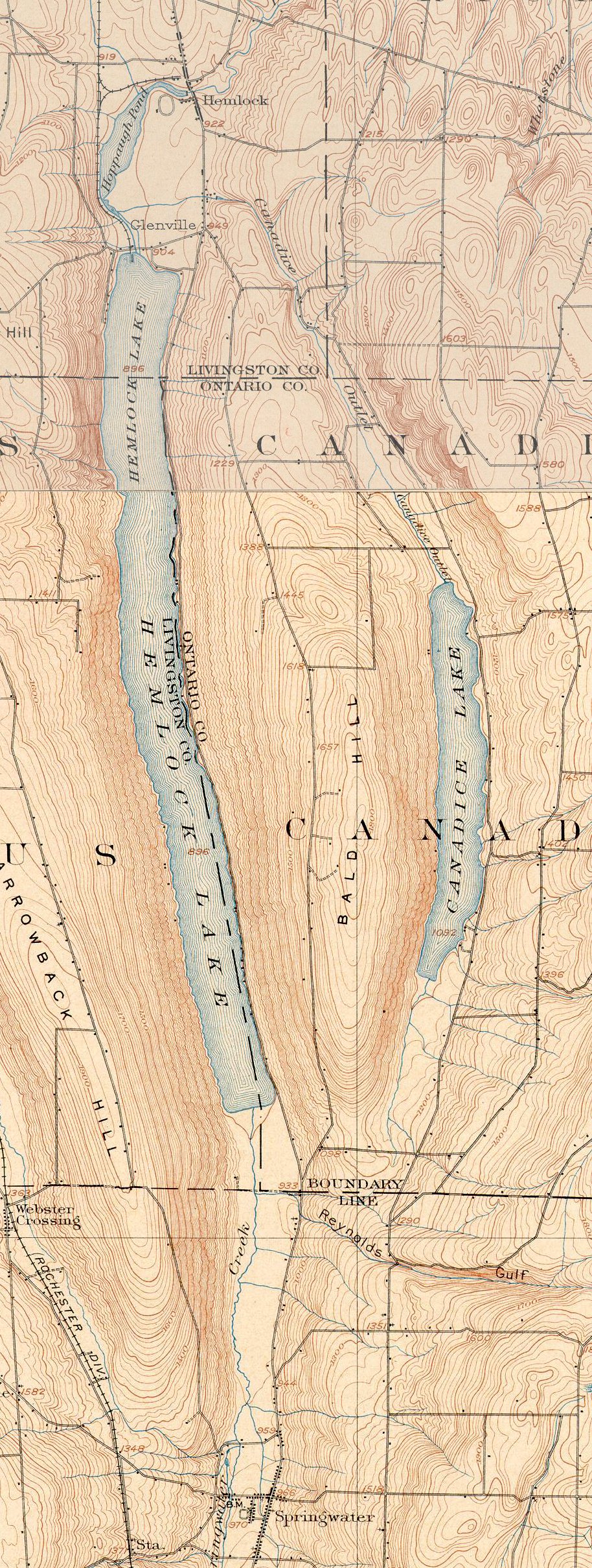
Topographical map of Hemlock and Canadice lakes from the 1904 maps at http://docs.unh.edu/NY/wayl04ne.jpg and http://docs.unh.edu/NY/hone04se.jpg
Next Sunday we will take the opportunity to walk the beach of Hemlock Lake. This hike will postpone the planned hike of Clark’s Gully and will take advantage of the low water level in Hemlock Lake. We hope we have not inconvenienced anyone, however we decided to “seize the moment” of one of our “little finger lakes” natural features that hasn’t been seen in over 5 years.
Looking at the US Geographical Survey topographical map of Hemlock Lake from 1904, you will see the original east lake road. The portion of this road near the middle of the lake has been underwater since 1936 or 1947 when the City of Rochester raised the level of the lake,
We will meet at the North Boat Launch on Hemlock Lake this Sunday, October 14 at 2:00 sharp. Please wear orange vests or bright clothing due to bow season and possible hunters in the area. We will be on the rocks of the shoreline – wear appropriate shoes (sturdy shoes with a grip for wet or slippery rocks). Please note that the extended hike can take up to 3 hours.
The after hike social will be at the Hemlock Grill at 5:00.
Hemlock Lake’s water levels are lower than most years due to our lack of rainfall. About half way down on the east side of the lake there are cliffs that are usually impassable without entering the water. However this fall you can walk from the North Boat Launch to the South Boat Launch entirely by shoreline, a distance of about 6 miles. The shoreline is rocky, gravelly, and zebra mussels are plentiful. The views and fall foliage around the stillness of the lake waters are picturesque. Foundations of old houses that are not usually visible can be explored. Bring a camera.
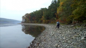
Climbers(advanced) will get a quick start to walk 6 miles from the North Boat Launch to the South Boat Launch. They will be transported back to the North Boat Launch via the sugarbus. This hike will take approximately 3 hours. Tourists (intermediate) will walk the same route and return for a distance of 4 miles. Naturalists will follow a similar shorter route of about 2 miles that encompasses the shoreline and woods to look for mushrooms, fall plants, and fossils.
Click here for directions to the North Boat Launch.
Its raining right now, but the weather sites are calling for improvements by 2:00. Expect a nice afternoon with some sun poking out!